Touch history. Then talk to it.
Watch a real lesson unfold: a student circles the Louisiana Purchase on a live map, and Tactile History builds the lesson — grounded in the actual 1803 treaty, Jefferson’s letters, and period cartography from the world’s public archives.
Above: a student traces the Louisiana Territory on the classroom panel — ~828,000 sq mi, Mississippi River to the Rockies.
STEP 2 • THE LESSON
A lesson built from the actual documents
In seconds, a Claude vision model returns a lesson keyed to the drawn region and the selected time period: $15 million paid on April 30, 1803, ~4¢ per acre, roughly doubling the United States overnight.
Every claim is anchored to sources the student can open with one tap.
STEP 3 • THE CHECK
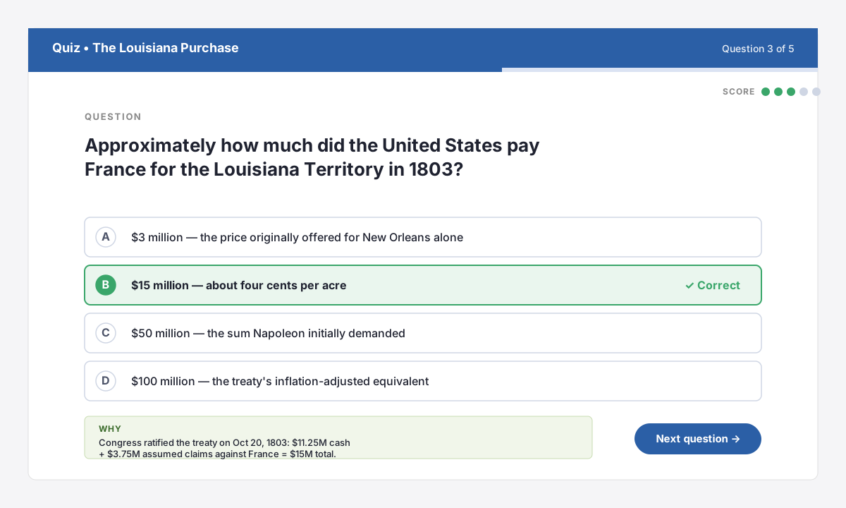
Five-question quiz, one tap away
Turn any lesson into a five-question multiple choice quiz. Students tap to answer. The panel shows the right answer and a plain-language explanation grounded in the lesson text.
Great for exit tickets, warm-ups, or whole-class review.
STEP 4 • THE ARCHIVE
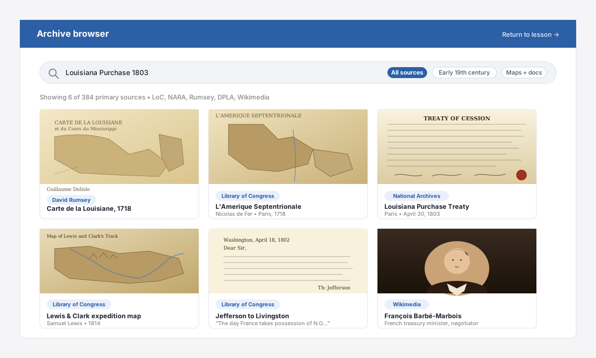
From summary to the real thing
Behind every lesson: a searchable archive drawer that surfaces Delisle’s 1718 Carte de la Louisiane, the original 1803 Treaty of Cession from the National Archives, Lewis & Clark’s 1814 expedition map, and Jefferson’s own letters.
Full pinch-zoom, no login, no leaving the app.
Physical zoom
Students pinch, pan, and circle any region on a live map or curated historical basemap with a finger.
Vision-grounded lessons
A multimodal Claude model sees the same map the class sees and writes a lesson for that exact place and period.
Selectable periods
Pre-1500, Age of Exploration, Early 19th c., Civil War era — every lesson stays inside the window you pick.
Built-in review
Generate multiple-choice questions from any lesson with one tap. Instant feedback, no answer key required.
Real archives
Browse Library of Congress, David Rumsey, Europeana, Internet Archive, Wikimedia, NARA, and DPLA from inside a lesson.
Built for classrooms
Device-bound licenses, no student PII collected, admin dashboard for districts.
In the room with students
A wall-mounted Android panel becomes the lesson surface. Students circle the region they want to discuss; the app reads the touch path, snapshots the map, and asks a vision-language model for a grounded lesson keyed to your time period.
No keyboards, no student accounts, no PII collected. Each panel runs one license — and, as in the photo, we blur student faces by default in any marketing material.
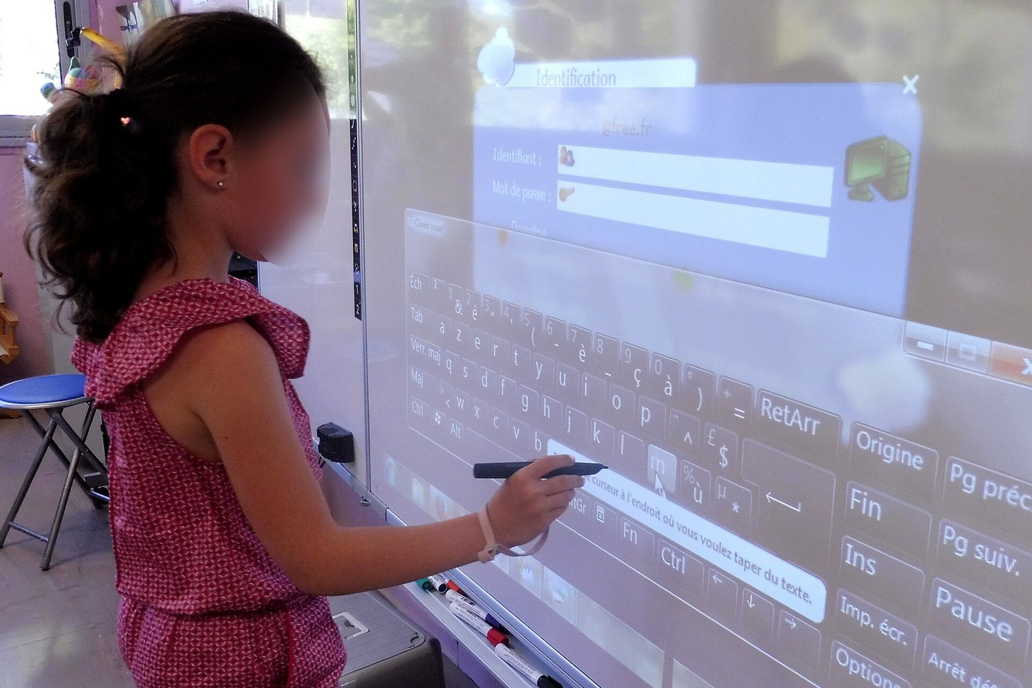
Photo: Als33120, CC BY-SA 4.0, via Wikimedia Commons

Ready to bring history to life?
No credit card to start. License binds to one classroom panel.